
Ice storm warning is issued
An Ice Storm warning has been issued from 9:22 a.m. Friday, Jan. 23, through 1 p.m. Monday, Jan. 26, by the National Weather Service for portions of central South Carolina.
Forecasters warn of significant icing, with ice accumulations between one-quarter and one-half inch, along with sleet and snow accumulations up to one inch. The storm is expected to impact the region from 1 p.m. Saturday through 1 p.m. Monday.
Power outages and tree damage are likely as ice builds on power lines and limbs. Travel could become nearly impossible, and hazardous conditions may disrupt the Monday morning commute, officials said.
Winter weather is expected to move into South Carolina Saturday evening and persist into Monday morning, bringing a mix of ice, sleet, snow, and freezing temperatures.
As the system approaches, the South Carolina Emergency Management Division has raised the state’s readiness level to Operating Condition 2.
The move follows Gov. Henry McMaster’s declaration of a state of emergency, which activates state emergency plans and allows agencies to coordinate resources and respond quickly to county requests.
Emergency management officials are urging residents to prepare now. Hazardous winter conditions can make travel dangerous, cause downed power lines, and increase the risk of cold-related injuries.
“Taking a few steps now to prepare your family, home, and vehicle can make a significant difference in staying safe when conditions worsen,” said Kim Stenson, director of the South Carolina Emergency Management Division. “Don’t wait until the storm arrives. Get ready today.”
Safety guidance includes:
–Prepare an emergency kit with non-perishable food, water, medications, flashlights, batteries, a first-aid kit, and important documents to last at least three days.
–Avoid travel if possible, especially during freezing conditions or overnight. Watch for black ice.
-If travel is unavoidable, slow down, increase following distance, and remain alert.
For minor crashes without injuries, move vehicles off the roadway and contact local law enforcement or dial *HP (*47).
–Share travel plans with family or friends, including destinations and expected arrival times.
-Check on animals, ensuring access to food and water; shelter them indoors when possible.
–Protect pipes by insulating exposed lines and allowing faucets to drip overnight to prevent freezing.
–Stay away from downed power lines and report outages to your utility company.
–Use alternative heating safely: properly vent fuel-fired heaters, keep generators outdoors and away from windows and doors, never burn charcoal indoors, and never operate portable generators inside.
Reduce fire risks by keeping combustible items at least three feet from space heaters and keeping fire extinguishers accessible.
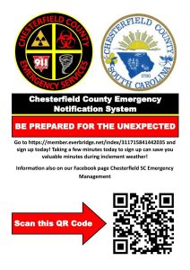
In addition, Chesterfield County Emergency Management officials are encouraging residents to sign up for the Chesterfield County Emergency Notification System to receive timely alerts and updates. Residents can register online at https://member.everbridge.net/index/311715841442035 or by scanning the provided QR code.
Officials stress that conditions may change rapidly and urge residents to continue monitoring local forecasts and official alerts as the winter storm approaches.