
Chesterfield County under winter storm, extreme cold watches
 Chesterfield County and much of central South Carolina are under a Winter Storm Watch and Extreme Cold Watch as a weather system is expected to bring significant snowfall and dangerously cold conditions from Friday evening through Sunday.
The National Weather Service in Columbia issued the Winter Storm Watch at 12:52 p.m. Thursday, Jan. 29 through 1 p.m. Sunday, Feb. 1.
Forecasters say heavy snow is possible, with total accumulations of 5 to 8 inches. Winds could gust as high as 35 mph, creating hazardous travel conditions.
Roads, particularly bridges and overpasses, are expected to become slick and dangerous, and travel could be very difficult at times, according to the NWS.
In addition, an Extreme Cold Watch was issued at 11:49 a.m. Thursday, Jan. 29, and remains in effect through 10 a.m. Sunday, Feb. 1.
Wind chills could dip as low as three degrees below zero, increasing the risk of frostbite and hypothermia if skin is exposed for extended periods. Prolonged freezing temperatures may also lead to ruptured water pipes, forecasters warned.
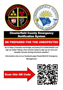
Chesterfield County Emergency Management officials continue to encourage residents to sign up for the Chesterfield County Emergency Notification System to receive timely alerts and updates. Residents can register online at https://member.everbridge.net/index/311715841442035 or by scanning the provided QR code.
As of Thursday, Jan. 29, the South Carolina Emergency Management Division said it is actively monitoring the system and coordinating with the State Emergency Response Team, the National Weather Service, and local emergency managers to track conditions and share updates statewide.
“Residents and visitors should stay informed and take steps now to prepare for winter weather,” said SCEMD officials in a statement.
Emergency management officials urged the public to understand the difference between winter weather alerts.
A Winter Storm Watch means snow, sleet or freezing rain is possible, typically issued 36 to 48 hours in advance.
A Winter Storm Warning indicates significant winter weather is expected and is usually issued 12 to 36 hours before impacts begin.
A Winter Weather Advisory signals less severe conditions that may still cause travel difficulties.
SCEMD recommends avoiding unnecessary travel, noting that road conditions can deteriorate quickly. Those who must travel should ensure vehicles are winter-ready and carry emergency supplies, including blankets, food, and water. Authorities emphasized that 911 should be used only for life-threatening emergencies.
Residents are also encouraged to prepare for potential power outages by charging mobile devices and keeping flashlights and extra batteries on hand.
Generators should be used outdoors only and kept away from windows and doors. Grills and fuel-burning heaters should never be used indoors.
To protect homes, officials advise insulating exposed pipes, opening cabinet doors to allow warm air to circulate, and letting faucets drip overnight to help prevent freezing. Neighbors and loved ones — particularly older adults, people with disabilities, and others who may need assistance — should be checked on during the cold spell.
Pet owners are urged to bring animals indoors, while livestock should have access to shelter, unfrozen water, and adequate food.